
gps & COMPASS
Let’s face it there is nothing new about the GPS. This device or perhaps the term GPS has been around for years. They come in any number of shapes and forms, from Street Navigators, Hand Held devices to GPS Mobile Phones and many others. I suspect that there are even some people who probably have one without realizing it.
Over the past few years I have noticed that more and more hunters are adding the GPS to their hunting kit. And again, the variety in terms of brands, models is always changing to the point that even the technology gurus would have some difficulty keeping up.
Now the question one has to ask is, are we as hunters too reliant on technology? What did the guys and girls do before the GPS? Did they all spend their time in the bush lost? Obviously the answer is no, at least to being lost. However, I meet a lot of hunters who are very much reliant on technology and to some degree would find it difficult to find their way around the bush without their GPS.
I think the majority of hunters who use GPS tend to be happy with being able to enter their starting or end points and then using the GPS to find them again. Now this is no problem in the majority of cases. The thing about a GPS is that if you are going to rely on finding your way with it, you really need to know how to use it and understand at least some of the basic setup parameters and what effect they have on what the GPS is telling you in terms of navigation information. Now this is not something you should be doing on your hunt. A GPS is only as good as your knowledge on how to apply what it can do. Your device may have all the bells and whistles, but if you don’t know how to use them or what they mean then all you are going to end up is frustrated and will spend more time trying to work out how to use it instead of hunting.
I think it is important to first do some homework on what exactly you need from a GPS. If you are only going to use it to find your way back to your camp or perhaps a deer for later retrieval then buying a GPS that has a long list of features that you are unlikely to use does not make sense. However, if you need your device to do things like say store maps or marine charts then you mostly likely need a more sophisticated unit and your learning curve will be much steeper than with a basic GPS.
Now these pages are not going to cover all the brands and respective models that are available nor will it tell you how to use them. That is something you need to do and then practice with the particular unit until you are confident with it.

Bushnell’s very basic model GPS
The next thing that I believe you should have is a basic understanding of what all the information on the GPS screen means. There is mountain of information available on the concepts of navigation. You can find it on the internet or books from map shops, outdoor stores and many more. This is particularly important if you are going to combine your GPS with a map.
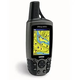

Various Garmin GPS models.

If I was going to fault GPS devices in general, then it would be that they require batteries to operate. Even if you carry spare batteries in your backpack, if these have been there for a long period even if brand new will eventually lose their charge. It has happened to me on more than one occasion, having turned on my GPS only to find that the batteries are nearly flat. Then changing then for a new set I always carry only to find that they are not much better.


Various Magellan GPS models.

If you are relying on your GPS in this scenario and happen to be in an area that you are not familiar with then this could be a problem. It is for this reason I always carry a compass to go with my GPS. Despite most GPS’s having a built in compass I do not rely on it. This method also has an additional benefit, in that if you know how to use a compass and understand bearings and headings from your GPS then you can potentially extend your battery life on your GPS by at least double.
The method I use is to allow the GPS to acquire its satellite lock. Following this I select the required location from the device memory and then select the “goto” function. The GPS respond by displaying the necessary navigation information. I then note the compass bearing and switch the device off. Knowing the bearing to my intended destination I then use the compass to work out in which direction I need to go. Once I know the direction I note an appropriate landmark. This then allows me to continue hunting in the general direction of my chosen landmark. I continue repeating this process until I reach my destination.

Typical orienteering compass.
If you are going to use this method then there is one important piece of information you need to know. One of the settings on pretty much all GPS units is what type of North the unit is set on. This is usually one of three choices.
1. Magnetic North – This is the same as a compass.
2. True North
3. Grid North.
Now the difference between these three setting is basically an angular number of degrees. This number will also vary slightly depending on your location (in the world). Usually the exact number can be worked out from the map legend of the area you are in. However, to illustrate the importance of using the correct setting, let’s say that you are using true north on your GPS. In addition you are using a compass to follow the bearing the GPS has worked out. Also keep in mind that the GPS will work out the distance to destination as a straight line and takes no consideration of terrain. This means that the actual distance you travel will be greater. Ok, so you are now happily following the bearing using your compass. Because there is a difference of let’s say 12 degrees between True North and Magnetic North the further you travel the more off course you will be. Refer the diagram below.

Difference between Magnetic North & True North.
As you can see from the diagram above over the 3km distance you would be 640 meters off to one side of your destination. In addition, because you will not be able to travel in exactly a straight line due to terrain and also the distance you will travel will be greater due to terrain you may in fact end up even further away.
Of course you can use your GPS compass the same way, although on some older models you need to be moving for the compass to work. In addition trying to hunt and simultaneously watching your GPS screen is not something that is practical. Also on some new models the compass must be calibrated in order to be accurate. You need to find this out from the instruction manual before relying on the compass to be pointing in the right direction. The advantage in this method is that you do not need to worry about the type of North setting selected. The downside to this method is if for any reason you cannot establish satellite lock then obviously when you reach your first chosen landmark you will not be able to establish which way to go.
So really in the end you need to decide what is the best way of using your GPS for you and be confident that you know how to do it. And it never hurts to have a contingency plan should something go wrong.
Ken Leatham.